Depoe Bay weather is the reason people come in winter. This small harbor town sits on a basalt headland between Newport and Lincoln City, and in the stormy months the Pacific arrives on its rocks with real force. If you have only seen Depoe Bay on a bright summer day, the winter version is a different place, and understanding it is part of understanding what it is like to live here.
A note on method: we are deliberately not quoting temperature or rainfall numbers. Those belong in official records, so for the figures use the National Weather Service Portland office, the Western Regional Climate Center, and the NOAA climate normals. What follows is the character of each season and how storm watching works.
What Is Depoe Bay Weather Like Through the Year?
Depoe Bay has the maritime coastal climate of the rest of the Oregon coast. Oregon State University’s climate summary for Oregon’s coastal zone describes a mild, wet winter and a drier summer, with fog a regular part of the year and strong winds that tend to arrive ahead of winter storms. The ocean tempers the extremes, so neither deep cold nor heat is the usual story. The National Weather Service Portland office covers the central coast.
Spring is changeable, with sunshine, showers, and sea fog in the same day. Summer is the drier season and the busiest, and the morning fog often lifts by afternoon. Fall is quieter and is when the first real storms can begin to show up. Winter is the headline.
When Is Winter Storm Watching Season in Depoe Bay?
The Oregon Coast Visitors Association says storm-watching season on the coast generally runs from November through March, with king tides in November, December, and January. The town is built for it. A swell that has traveled across open ocean meets the basalt headland and the harbor wall here, and the spray can carry onto Highway 101. The Oregon Department of Transportation has photographed higher-than-usual tides spraying waves onto US 101 at Depoe Bay, which is worth remembering if you are driving through during a big tide.
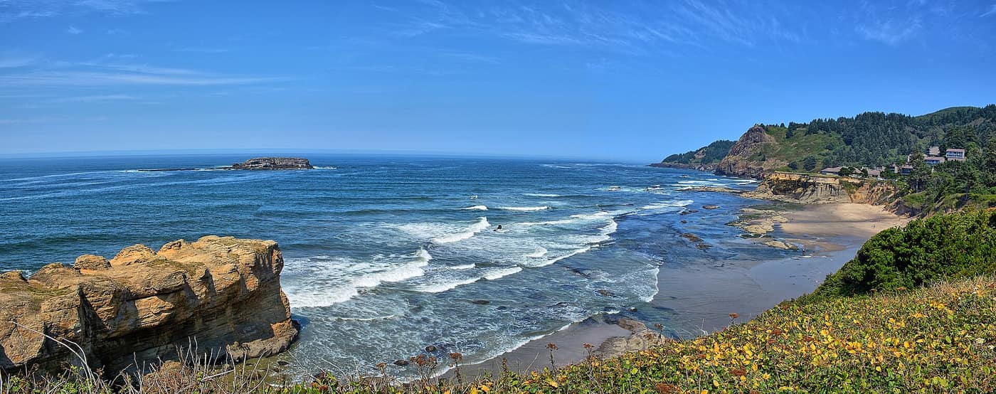
The coast at Otter Rock, a short drive south of Depoe Bay — Photo: Kirt Edblom / Wikimedia Commons (CC BY-SA 2.0)
Where Do You Watch a Storm Safely?
The safest storm watching is the kind you do from a dry vantage point set well back from the edge. Near Depoe Bay, Boiler Bay State Scenic Viewpoint, north of town, is described by Oregon State Parks as a rugged, basalt-rimmed bay and a good place to see surf on its rocky spurs. To the south, Devils Punchbowl State Natural Area sits near Otter Rock, and our Spouting Horn and Devil’s Punchbowl guide shows the wave show from the harbor to the Punchbowl. Check current conditions and access with the park before you go.
The advice that applies everywhere on this coast is simple. The Oregon Coast Visitors Association’s beach safety guide says to never turn your back on the ocean, to stay off logs in the surf or on wet sand, to assume cliff edges are unstable, and to avoid exposed rocks, jetties, and headlands during strong wave action, including during and after storms. Its storm-watching guide suggests warm layers, rain gear, waterproof boots, and tracking the tide tables on the NOAA website.
What Else Is There to Watch Between Storms?
The headlands are not only for storms. Oregon State Parks says gray whales can be seen at Boiler Bay year round, and our whale watching guide notes that the southbound migration runs from about mid-December through January, right in the middle of storm season. A calm, clear winter day can be as rewarding as a stormy one, with sharp light over the water. The harbor is also worth a walk on a quiet day, and our Depoe Bay dining guide covers places to warm up afterward. Confirm hours with each business before you go.
How Do You Plan a Storm-Watching Trip?
Plan around a forecast rather than a date. Check the National Weather Service Portland office before you leave and check TripCheck for road conditions. Depoe Bay is a small city, and several services people expect in town, such as the hospital, are listed under neighboring Lincoln City or Newport, so a bad-weather day can mean a longer drive than you expect. Storm season rewards flexibility: if the weather looks tame, wait a day.
What Depoe Bay Weather Means If You Are Buying
The weather is part of the address. For a cliffside home, our deep dive suggests looking closely at erosion and landslide mapping and asking about drainage and setback from the edge. A few more questions are worth asking:
- Exposure. How exposed is the home to wind and salt air? Ask how the roof, siding, and windows have held up.
- Hazard maps. Learn the tsunami evacuation route and check the FEMA flood maps for any address you consider.
- City limits. Whether an address is inside Depoe Bay changes who provides services and sets the rules.
Ask neighbors and sellers how a particular street handled past storms, including drainage, wind damage, and power, and ask your insurance agent what a policy covers for storm and flood damage. Those answers tell you more about an address than a view alone.
If a storm on the rocks sounds like a feature, not a warning, our guides to whale watching in Depoe Bay and living in Depoe Bay show why people stay.
Related reading
- Depoe Bay Town Guide
- Living in Depoe Bay: A Deep Dive
- Spouting Horn to Devil’s Punchbowl: Depoe Bay’s Wave Show
- Whale Watching in Depoe Bay
- Living in Depoe Bay
Previously on the blog: Devils Lake: Lincoln City’s Other Waterfront
Next up: Florence, Oregon Weather by Season →
Watch the Storms Roll In From Your Own Window
If a winter swell on the rocks sounds like the best show in town, let’s talk through financing a Depoe Bay home with Phuong.
Get Pre-Approved Talk Financing With Phuong